


Madeire7

HERRY
User GUIDE

Length
21 km

Max alt
1497 m

Uphill gradient
1689 m
Km-Effort
44 km

Min alt
556 m

Downhill gradient
1949 m
Boucle
No
Creation date :
2022-09-12 08:32:39.0
Updated on :
2022-09-12 16:06:43.326
7h33
Difficulty : Very difficult

FREE GPS app for hiking
 SityTrail
IGN / Geographical institutes
SityTrail Plus
The world is yours!
About
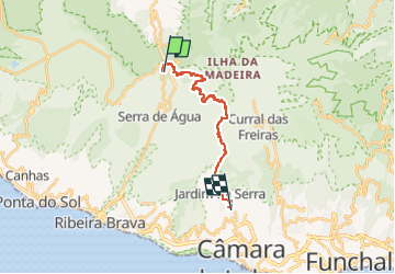
Trail Walking of 21 km to be discovered at Madeira, Unknown, Serra de Água. This trail is proposed by HERRY.
Positioning
Country:
Portugal
Region :
Madeira
Department/Province :
Unknown
Municipality :
Serra de Água
Location:
Unknown
Start:(Dec)
Start:(UTM)
310359 ; 3625333 (28S) N.
Comments